Geometry of Khalakan Anticline, Northeastern Iraq
Article Sidebar
Main Article Content
Abstract
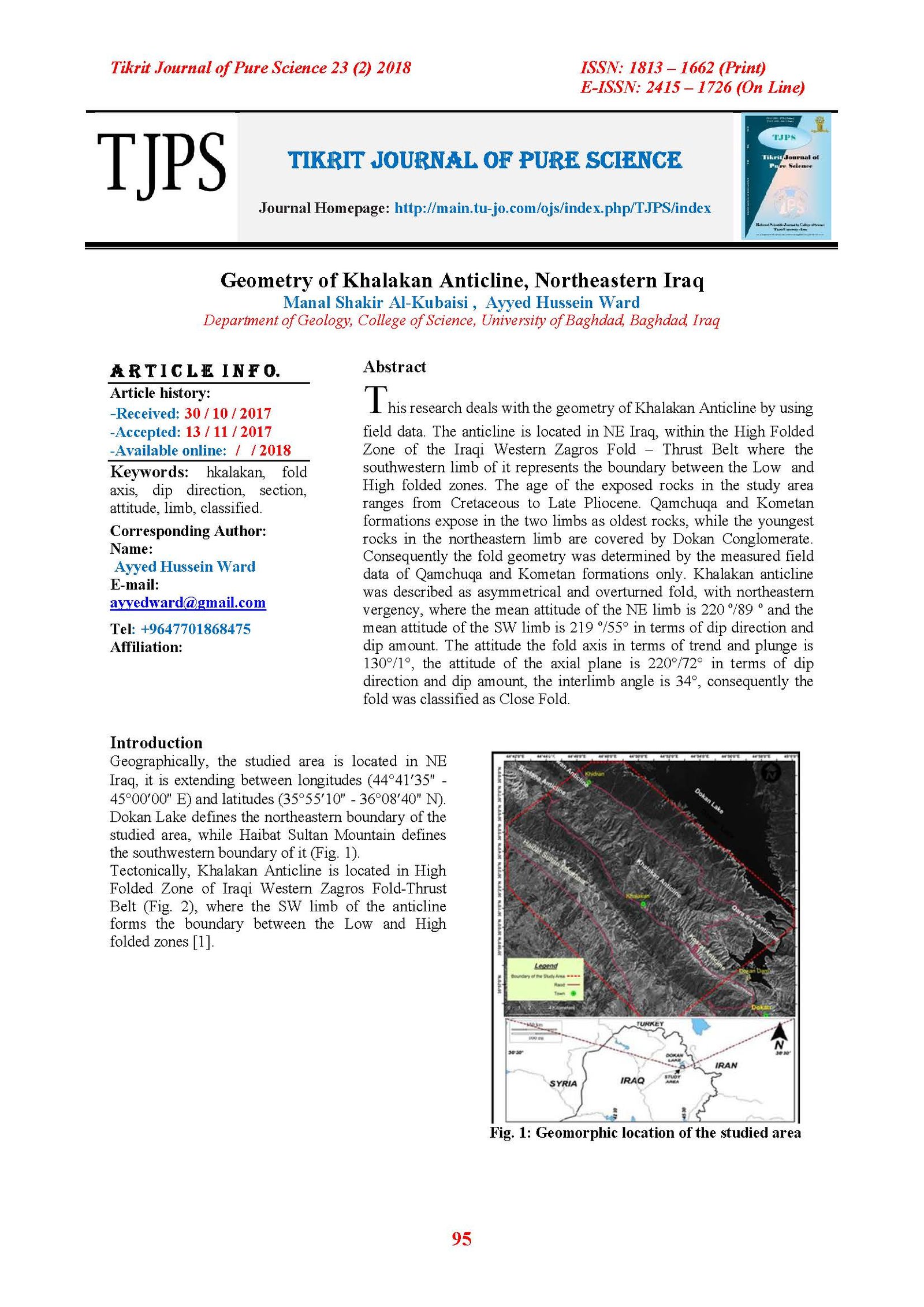
This research deals with the geometry of Khalakan Anticline by using field data. The anticline is located in NE Iraq, within the High Folded Zone of the Iraqi Western Zagros Fold – Thrust Belt where the southwestern limb of it represents the boundary between the Low and High folded zones. The age of the exposed rocks in the study area ranges from Cretaceous to Late Pliocene. Qamchuqa and Kometan formations expose in the two limbs as oldest rocks, while the youngest rocks in the northeastern limb are covered by Dokan Conglomerate. Consequently the fold geometry was determined by the measured field data of Qamchuqa and Kometan formations only. Khalakan anticline was described as asymmetrical and overturned fold, with northeastern vergency, where the mean attitude of the NE limb is 220 ᴏ/89 ᴏ and the mean attitude of the SW limb is 219 ᴏ/55° in terms of dip direction and dip amount. The attitude the fold axis in terms of trend and plunge is 130°/1°, the attitude of the axial plane is 220°/72° in terms of dip direction and dip amount, the interlimb angle is 34°, consequently the fold was classified as Close Fold.
Article Details

This work is licensed under a Creative Commons Attribution 4.0 International License.
Tikrit Journal of Pure Science is licensed under the Creative Commons Attribution 4.0 International License, which allows users to copy, create extracts, abstracts, and new works from the article, alter and revise the article, and make commercial use of the article (including reuse and/or resale of the article by commercial entities), provided the user gives appropriate credit (with a link to the formal publication through the relevant DOI), provides a link to the license, indicates if changes were made, and the licensor is not represented as endorsing the use made of the work. The authors hold the copyright for their published work on the Tikrit J. Pure Sci. website, while Tikrit J. Pure Sci. is responsible for appreciate citation of their work, which is released under CC-BY-4.0, enabling the unrestricted use, distribution, and reproduction of an article in any medium, provided that the original work is properly cited.
References
1- Fouad, S, F,A., 2014. Western Zagros Fold-Thrust Belt, part Π: The High Folded Zone. Iraqi Bulletin of Geology and Mining, Special Issue, No.6, p. 53 – 71.
2- Karim, K.H. and Taha, Z.A., 2012. The origin of Conglomeratic Limestone "Dokan Conglomerate" in Dokan Area, Kurdistan Region, NE Iraq. Iraqi Bulletin of Geology and Mining, Vol.8, No.3, p. 15 –24.
3- Sissakian, V.K. and Fouad, S.F., 2014. Geological Map of Erbil and Mahabad Quadrangles, scale 1: 250000, 2nd edition. Iraq Geological Survey Publications (GEOSURV), Baghdad, Iraq.
4- Keller, KA., Gurrola, L., and Tierney, T.E., 1999, Geomorphic criteria to determine direction of lateral propagation of reverse faulting and folding: Geology, v. 27, p. 515-518.
5- Fossen, H. 2010. Structural Geology, Published in the United States of America by Cambridge University Press, New York, 463 P.
6- Turnner, F.J. and Weiss, L.E. 1963. Structural Analysis of Metamorphic Tectonites. McGraw-Hill book Co. Inc., New York, 545 P.
7- Ramsay, J. G., 1967. Folding and fracturing of rocks. McGraw-Hill book Co., New York, 568p.
8- Lisle, R.J., Toimil, N., Aller, J., Bobillo-Ares, N., and Bastida, F., 2010. The hinge lines of non-cylindrical folds, Journal of Structural Geology 32, 166–171.
9- Fleuty, M. J., 1964. The description of folds. Geol. Assoc. Lond. Proc., 75, pp. 461 - 492.
10- AL-Azzawi, N.K., 2003. The Structural Development Of Folds Shape in the Foreland Belt of Iraq, and its tectonic implication. Unpub. Ph.D thesis, Mosul University (in Arabic), 163p.