Evaluation of Hydrogeological Conditions, of the groundwater reservoir west of Samarra by using Data pumping tests in wells Single
Article Sidebar
Main Article Content
Abstract
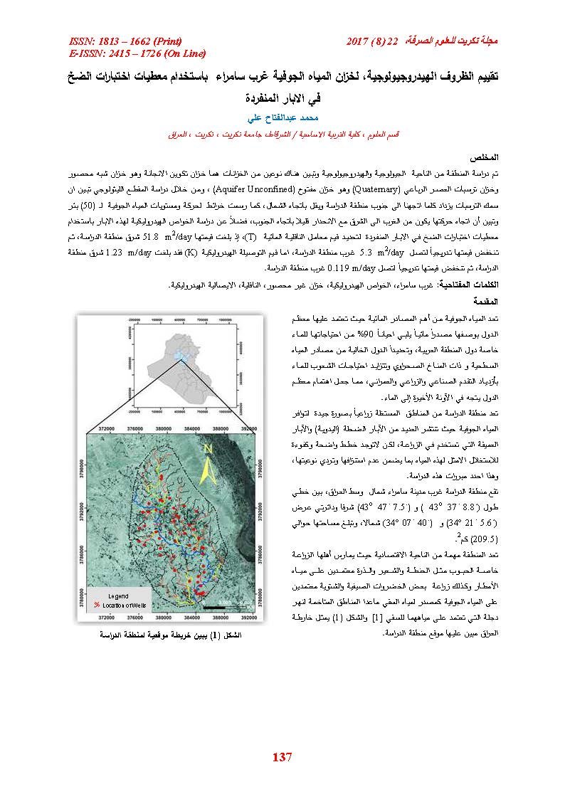
Geologicall and hydrological evaluation have carried out (50) wells east of Samarra, Its study explained thate and two aquifers were distinguished; Injana as semi-confined aquifer and Quaternary sediments as unconfined aquifer. The study of the lithological section shows that the thickness of the sediments increases as we move to the south of the study area and decrease to the north. Of the movement and groundwater levels of (50) wells. It was shown that the direction of its movement is from west to east, with a slight slope towards the south, as well as studying the hydraulic properties of these wells determine by using the pumping test data in the individual wells to determine the values of the Transmssivity (T), (51.8 m2/day) east of the study area, gradually decreasing to (5.3m2/day) west of the study area. The values of the hydraulic conductivity (K) reached (1.23 m/day) east of the study area and gradually decreased to (0.119m/day) west of the study area.
Article Details

This work is licensed under a Creative Commons Attribution 4.0 International License.
Tikrit Journal of Pure Science is licensed under the Creative Commons Attribution 4.0 International License, which allows users to copy, create extracts, abstracts, and new works from the article, alter and revise the article, and make commercial use of the article (including reuse and/or resale of the article by commercial entities), provided the user gives appropriate credit (with a link to the formal publication through the relevant DOI), provides a link to the license, indicates if changes were made, and the licensor is not represented as endorsing the use made of the work. The authors hold the copyright for their published work on the Tikrit J. Pure Sci. website, while Tikrit J. Pure Sci. is responsible for appreciate citation of their work, which is released under CC-BY-4.0, enabling the unrestricted use, distribution, and reproduction of an article in any medium, provided that the original work is properly cited.
References
2. Parson, R., M. Company, (1955): Ground water
Resource of Iraq, Vol. 3, Baiji – Samarra area
Development Board, Ministry of Development Los.
Angeles, California, PP. 98.
3. Dangramji, J. and Vbell,K., (1970): Preliminary
studies on ground water in samarra – Tikrit area,
Technical Report, No. 13, council for science
Research Baghdad, Iraq. PP. 30.
4. Krasny, J., )1982 : Hydrogeology and
hydrochemistry of Tikrit – Baquba area, SEGSMI,
unpub. Report, PP. 73.
5. Kruseman, G.P. and Deridder, N.A., (1979).
Analysis and Evaluation of Pumping test Data, Int.
Inst. Forland Reclamation and Improvement, 209P.
6. Al – Furat center for studies and Desgins, )1989 :
Hydrogeologic investigation within Tikrit – Samara
area, part, 1, 2, 3,. Μnpubl. Report, Baghdad.
7. Hamza, et al., 1990, Regional geological stage
report, SEGESMI, Baghdad.
14. Barwary, A.M., (1983): Regional Geological
Survey of Khazir-Comel Area. Unpubl, SOM,
Report, No.1137, part 1, SOM Library, PP. 6-23.
15. Basi, M.A., et.al., (1990): The Stage Report of the
Local Geological Survey,Vol.2,Laboratory Studies.
17. Jassim, S.Z. and Goff, C.J., (2006): Geology of
Iraq, Published by Dolin, Prague and Moravian.
Museum, Brno, 341 P.
19. Raghunath, H.M., (2006): Hydrology (Principles,
Analysis, Design), 2nd, Ed., New Age International
Ltd, New Delhi, 463P.
20. Hudak, P.F., (2000): Principles of hydrogeology,
second edition, Lewis Publisher, Florida, U.S.A.,
204P.
21. Walton, W.C. (1970): Groundwater, resource
evaluation, McGraw Hill Int. Book Comp. New
York, 664P.